Contacts
- La Commanderie
- 543 rue de la Commanderie
- Rulhe le Haut - 12390 Auzits
- : +33 (0)6 16 12 00 71
- : Use the form opposite
GPS coordinates
- Latitude : N 44°29'40.918"
- Longitude : E 2°17'27.995"
Location
In the heart of Aveyron, 5 minutes from the Château de Bournazel, the thermal baths of Cransac and the shops; 20 minutes from Conques, the Lot Valley, Belcastel and Rodez Airport; nearly an hour from the Millau Viaduct, the Gorges du Tarn, Roquefort, Rocamadour-Padirac, Saint Cirq Lapopie, Aubrac and Najac.
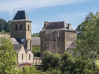
Rulhe le Haut is a picturesque little village nestled in the heart of verdant nature and ancient forests irrigated by marked hiking trails.
Access
By road
Route from Rodez
Since Rodez head to the airport,
- Once you passed the airport, continue on the D 840 towards Brive/Decazeville,
- in St Chrisophe take the direction of Cransac on D11, after 9 km turn on the left direction Auzits,
- after 6 km turn on the left onto the D53 up to "Rulhe le Haut".
- The Commandery is facing the Church.
Itinerary from the A20 motorway
From A20
- Take exit 56 towards "Rodez/Figeac/Decazeville/Gourdon",
- Continue in direction of Figeac/Decazeville on D802 then continue on D840 still in direction of Decazeville/Rodez before arriving in Decazeville turn onto the D5 in direction of Aubin,
- Continue on D5 (on the right hand-side after Aubin) then after 2km turn left onto the D148 for 4 km to Rulhe and Rulhe le Haut (church).
- The Commandery is facing the Church.
By air
Rodez-Marcillac Airport
From Rodez-Marcillac Airport :
- Take direction of D840 direction Brive/Decazeville,
- in St Chrisophe take the direction of Cransac on D11, after 9 km turn on the left direction Auzits,
- after 6 km turn on the left onto the D53 up to "Rulhe le Haut".
- The Commandery is facing the Church.
